Valleys, Routes, and Crossings
20 Major Crossings
These crossing trips all involve travel above the bushline. Make sure that your gear and route-finding abilities reflect the possibility of alpine conditions.
- Severe conditions may be expected at all seasons of the year.
- Winter crossings will need ice axe and perhaps crampons.
- Be prepared to turn back if conditions get too tough – the hills will still be there next weekend and you will be better prepared.
- But don't forget your sunscreen and camera.
20.8 Main Range (south to north) 
The Tararua Main Range runs from Bridge Peak on the Southern Crossing, over the central higher peaks, to finish beyond Ruapae in the north. It is part of the watershed spine of the North Island running from Turakirae Head in the south. There are many convenient entry and exit points throughout its length, and a number of the ‘crossings’ travel along it for some distance. This route is described from south to north, though the reverse direction is mentioned in a few places for clarity. Essentially all the peaks above 1,500 metres in the Tararuas lie between the fault lines of Ōtaki–Mangahao in the West, and of Tauwharenīkau–Ruamahanga in the East.
One of the marathon 24-hour trips in the Tararuas is the Schormann (now Putara road-end) – Kaitoke trip. This is done from Mangatainoka, along the Main Range to Arete, then S through Holdsworth and the Tauwharenīkau Valley to Kaitoke. The tougher version traverses the whole of the Main Range and finishes up with the Southern Crossing and down the Marchant Ridge to Kaitoke. It can be difficult to take enough food, and even more difficult to take sufficient water. The 'full main range' version climbs (and descends) about 9,000 m on the 50 km journey, and the 'Holdsworth' route about 6,000m. All over a 24-hour, or perhaps a 2-day period.
The Main Range from Pukematewai to Mt Crawford is part of the Te Araroa Trail.
Bridge Peak to Maungahuka
4–6 hours
From the SE shoulder of Bridge Peak, the ridge drops 300 metres of height in the first 1,500 metres of travel to commence its undulation northwards over Boyd-Wilson to Vosseler. (The long spur leading from before Boyd-Wilson into Penn Creek should not be mistaken for that off Vosseler.) Two hundred metres past Vosseler, a R turn leads through saddle and scrub over Yeates to McIntosh, 2 hours or more from Bridge Peak. Two hundred and fifty metres or so N of McIntosh the ridge swings R to drop into a small saddle, with a reliable tarn alongside the ridge. This R swing marks the junction of the long Pakihore Ridge.
Soon the Tararua Peaks are engaged, nowadays a somewhat easier proposition with a 25-metre ladder leading down the first steep face. Try to not damage the fragile vegetation. A rocky section leads around a spur to the W then back to the main ridge. A further steep descent gives way to a scramble up a scree gully to gain the ridge just S of Maungahuka.
The Tararua Peak section of the range is quite exposed and presents difficult alpine conditions in snow. It must not be taken lightly.
Emergency exit. The Concertina Knob turn-off is the better escape route in storm from the top of Maungahuka, then out via Cone Ridge and Walls Whare or Totara Flats. If the Tararua Peaks need sidling (usually only a problem heading southwards), a drop through the headwaters of Whatiuru Creek to Pakihore Ridge is feasible. The spurs from Maungahuka and those to the Pakihore pose no problems other than bushcraft and time.
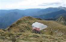
A couple of minutes N of Maungahuka is the welcome hut, at the near end of the large tarn and 90 minutes or more from McIntosh. Maungahuku Hut sleeps ten, has water tank, and toilet.

Maungahuka to Anderson
About 4½ hours
The view from Maungahuka Hut, over Aokaparangi and Kahiwiroa towards Crawford, is rather grand: the foreground tussock concealing the discomfort of the scrub saddles around Simpson and Wright. The ridge N drops through a minor saddle and knobs, then over Simpson. It drops through deeper saddles before and after Wright, then climbs up to Aokaparangi, some 2½ hours from the hut. The scrub in these saddles is a little close on the track, and the well-trodden peat makes for slower travel than may be wished.
North of Aokaparangi and beyond a minor knob, a lengthy rough scrubby saddle leads to the extended bulk and twin summits of Kahiwiroa – a good hour from Aokaparangi. Fifteen minutes N from here an eroded knob marks a swing NW with a tricky entry to the bush-edge. A deeper saddle now leads through honest bush to Anderson Memorial Hut, just at the bush-edge again, a good hour away.
A cairn on Aokaparangi summit, with a rainwater billy, marks the turn-off to Mid-Waiohine. Heading southerly from Aokaparangi, the signposted turn-off to Aokaparangi Biv is met in a few minutes. Aokaparangi Biv (two bunks) is 20 minutes down a broad side-spur, secreted inside the NE bush-edge. The main ridge continues, also rather broad, heading SSW to the saddle N of Wright.
Emergency exit. The track off Aokaparangi to the Mid-Waiohine bridge offers a good escape route, but the exit over Holdsworth may be troublesome. From Andersons, a good route leads over Shoulder Knob to Waitewaewae Hut.

Anderson Memorial Hut
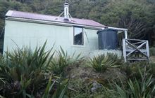
Anderson Memorial Hut is a Standard hut, located at -40.846, 175.356. There are 6 bunks with heating, mattresses, toilets - non-flush, water from tap - not treated, boil before use, and water supply. Bookings are not required, usage is first come, first served.Anderson to Nichols
About 2½ hours
The entire trail between the two huts lies above the bushline. From Anderson Memorial Hut, the trail travels gently over a broad tussock shelf and soon leaves the soft going behind as it climbs towards .1226 and the sparkling ridge-top tarn. On a fine morning this section N from Anderson is an inspiring high-level traverse with excellent views of the central ranges. An hour will bring the cairn marking Junction Knob, the turn-off to Waitewaewae, and 35 minutes or so more brings the flattish summit of Crawford itself, with its iron survey tube.
From Crawford the ridge first heads NNW but swings round in a broad curve to ENE over the next 35 minutes to Nichols, dropping at the same time. Nichols Hut lies in a basin 7 minutes down from the ridge and has its turn-off marked at a small saddle a few minutes short of Nichols. The junction of the Main Range with Nichols is 20 metres or so N of the actual summit of Nichols. Don’t overshoot the junction when heading S. [revised February 2019]

Nichols Hut
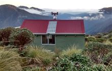
Nichols Hut is a Standard hut, located at -40.81, 175.376. There are 6 bunks with heating, mattresses, toilets - non-flush, water from tap - not treated, boil before use, and water supply. Bookings are not required, usage is first come, first served.Nichols to Arete
About 5 hours
From Nichols to Arete travel is mainly in the bush, emerging only briefly in the Kelleher–Puketoro region and again beyond Butcher Knob.
After a few minutes in tussock, the bushed ridge leading down to the Kelleher Saddle is reached, but stay in the tussock as long as possible before entering the bush. Once in the bush the grade soon eases to the undulations along the broad Kelleher Saddle. Eventually a scramble up a sharp rocky gut brings the open area of the Kelleher Junction, roughly 90 minutes from Nichols. Kelleher itself lies higher to the W off the Main Range. From the top of the gut turn R for 50 metres or so to re-enter the bush; then head through the saddle to Puketoro.
Puketoro is another European-generated Māori name, meaning 'triple-topped hill'. Coming S over Puketoro, don’t sidle too soon down the gravel faces on the Park side.
A gentler descent leads N from Puketoro, then a steeper rise to Dracophyllum Knob with its small clearing beyond, about 90 minutes from Kelleher.
Dracophyllum Hut is just inside the bush-edge, with two bunks. The helicopter rotor blades recall an aviator’s maxim: 'Any landing that you walk away from is a good landing.'
From the small clearing on Dracophyllum Knob, 60 minutes or less should bring Butcher Knob, and from here the going becomes progressively easier as the scrub is cleared, and the long ridge brings Pukematawai – up to 3 hours from Dracophyllum Hut, or 2½ hours in the reverse direction.
A further twenty minutes from Pukematawai brings Arete. There is a small moss soak on the Arete Ridge 100 metres NE of the summit.
Coming S along the Main Range from Pukematawai, the Te Matawai Hut turn-off is 2 minutes from the summit. Less than 10 minutes south from the summit, a branch spur leads straight ahead to provide good access to the Park headwaters. If this is not your destination then watch for it, particularly if you are in a fog. Directions to find the Arete Biv are given in 20.6. Arete as used here refers to the pyramid or alpine horn shape naturally generated by glacial action. In older Greek it means excellence or perfection. It should not be pronounced as a Māori word.
Pukematawai is a European-generated Māori name meaning 'hill at the head of the waters'. This refers to the Ōtaki, Mangahao, and Waiohine, each of which originates here. If you extend the concept slightly to include Arete and flanks of both peaks then you pick up the headwaters of the Waingawa, Ruamahanga and Ōhau as well.
Emergency exit. Several routes lead from the Main Range to the Ōtaki. From .1031 to Kelleher Stream; from Kelleher itself to the Ōtaki; from near Butcher Knob to the Ōtaki. Avoid dropping into the Park.

Dracophyllum Hut
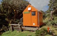
Dracophyllum Hut is a Bivvy or Basic hut, located at -40.77, 175.389. There are 2 bunks with mattresses, toilets - non-flush, water from tap - not treated, boil before use, and water supply. Bookings are not required, usage is first come, first served.Dracophyllum Hut alert
Ohau Gorge Track closed
The Ohau Gorge Track, that forms the first section of Gable End Track, is closed due to a significant slip beyond the Forest Park boundary on the track up the Ohau Gorge.
Take the alternate route along the Waiopehu Track. Six Disc Track is still open for those who want to access Gable End Ridge Track.
First published on 7 June 2022. Last reviewed on 26 September 2025.The Ohau Gorge Track, that forms the first section of Gable End Track, is closed due to a significant slip beyond the Forest Park boundary on the track up the Ohau Gorge.
Take the alternate route along the Waiopehu Track. Six Disc Track is still open for those who want to access Gable End Ridge Track.
First published on 7 June 2022. Last reviewed on 26 September 2025.Arete to Ruapae
6–7 hours.
This section of the Main Range, sometimes called the Dundas Range, is almost completely above the scrubline. Less frequently travelled, the trail is less eroded than that further south.
Ten minutes beyond Arete, and just beyond the first slight saddle, is the minor knoll .1434 where the Bannister Crossing swings E from the Main Range, which now turns a little more northerly. The next section of the range to Dundas is pleasant travel, a series of minor knobs leading to a 15-minute climb to Dundas itself – 90 minutes from Arete to Dundas. From Dundas, the route to Logan first bears 120° true and past a small tarn before swinging more NE to the Dundas-Logan saddle. Some of the rocky knob in this saddle is best sidled to the NW. (From Logan the ridge towards Dundas bears 240° true.) The ridge N from Logan bears 020° true and 25 minutes northwards is the summit of .1415. This minor summit carries several small tarns (and there is another tarn in the saddle beyond) and it marks the inconspicuous turn-off to Dundas Hut. The turn-off is however sign-posted, saying 10 minutes to Dundas Hut; allow at least 20 minutes. See section 2.8.
Further NE is Pukemoremore, its summit and sides rather rocky, and beyond is the top of Walker, 1¾ hours from .1415. From Walker, the ridge swings E for a little before resuming its NE trend. Because of the extended top on Walker, and the major east-trending spur that runs into Chamberlain Creek, be sure of your location before proceeding in poor visibility.
A good 45 minutes from Walker brings West Peak and the deep saddle that reaches down to the scrubline, between it and East Peak. About 75 minutes between the peaks. The summit of East Peak is a little broad, but the eastern-most part can be considered the highest. In the reverse direction, from East Peak to West Peak, avoid heading along Haukura Ridge; the route to West Peak turns sharply W on a section of ridge which is not well defined and swings around somewhat on a tussock knob before reaching the saddle.
Heading to Ruapae from East Peak, the route follows 120° true for 5 minutes, where a cairn marks the quiet departure of the ridge towards Ruapae, down a small scree slide on 030° true. The ridge that continues on the 120° true bearing becomes the Haukura Ridge, which indeed offers rocky scrambling.
Ruapae is a definite summit, 45 minutes from East Peak, and the turn-off spur swings easily E and downwards to Herepai, reached in about 45 minutes. From Herepai the track descends through increasingly healthy scrub and enters the bush to reach Herepai Hut in a further 45 minutes.
From Ruapae, the watershed spine of the North Island actually swings eastwards down through Herepai and Kaiparoro to cross the main road.
Emergency exit. Between Dundas and West Peak, do not consider the country to the east apart from the spur to Dundas Hut. Good spurs lead to the Mangahao from Dundas, Pukemoremore and West Peak, but avoid the Mangahao headwaters.
This work is licensed under a Creative Commons Attribution-NonCommercial-NoDerivs 4.0 International License.


